As Ben swims with the Kuroshio current away from Japan, radioactive cesium is following the same path. All of the world’s oceans contain cesium, but the recent (2011) accident at and continued releases from the Fukushima Dai-ichi nuclear power plant in Japan represent a new point-source of the element. Prior to this, radioactive cesium, which is a product of nuclear power and not naturally occurring in the ocean, was a relic of testing nuclear bombs and found only in low concentrations (Cs137 less than 2 Bq/m3). We’ve teamed up with Ben to take cesium samples along his route so that we can trace the movement of this contaminant away from Fukushima.
The Kuroshio is the strongest current in the western Pacific, akin to the Gulf Stream in the Atlantic. It travels northeast along the southeast coast of Japan, after which it peels away and starts its cross-ocean trek. Ben has been using this force to propel himself forward while wearing a device called the Rad-Band, developed by Ken Buesseler at the Woods Hole Oceanographic Institution.
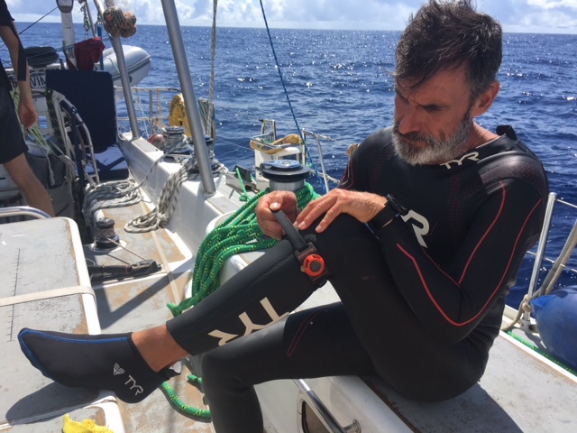
The Rad-Band is a wearable device containing a resin that traps cesium. The crew of Seeker are also taking water samples and processing them through the same resin. We can then compare the column and the Rad-Band cartridges and determine how much water is flowing past Ben’s foot as he swims, as well as how much radioactive cesium is in the water.
Previous sampling off the coast of Japan has shown that cesium levels drop quickly with distance from the shore. The Longest Swim has provided a platform for us to document the movement of radioactivity over a long distance and to compare our results from previous years to see how conditions have changed. Results from previous studies and more information about radioactive elements in the ocean can be found at OurRadioactiveOcean.org. We look forward to providing some results to the Longest Swim team soon and thank everyone for their efforts to obtain these precious samples!
Written by:
Jessica Drysdale
Research Assistant, Woods Hole Oceanographic Institution
Figure 1. Map of ocean surface currents with the strong Kuroshio current shown in yellow and red. Ben’s route will follow this current, as shown with the orange markers, as long as possible. Image from Windy.com.
Figure 2. Rad-Band®


5 thoughts on “A sea of cesium”-
-
-
-
-
Wow.
My admiration to the scientific work unser the challengeing circumstances.
???
good job!
good hopes to cheer ben up so he won’t be sick it is a good hope that ben does not get bit by sharks.
shame to japan and loss to rest of world!
it looks rufe clank clank l would be scard